Gambar:Europe location WAL2.png

Ukuran ieu pramidang: 800 × 600 pixel. Resolusi lianna: 320 × 240 pixel | 640 × 480 pixel | 1.024 × 768 pixel | 1.280 × 960 pixel | 1.600 × 1.200 pixel.
Berkas asli (1.600 × 1.200 piksel, ukuran koropak: 803 KB, tipeu MIME: image/png)
| Berkas ieu asalna ti Wikimedia Commons. Kaca ngeunaan katerangan berkas ieu di Commons aya disalin di handap. Commons téh hiji gudang berkas bébas nu eusina disumbang ku balaréa. |
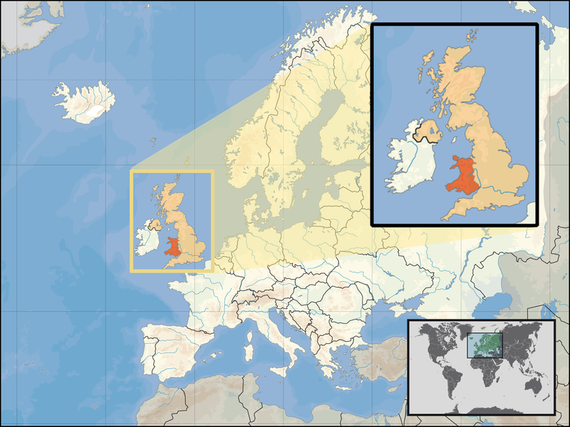
| Pedaran | Location of Wales in the UK and Europe, on terrain map showing surface and underwater contour areas. | |||
| Titimangsa | ||||
| Sumber | Derived from Wikimedia Commons image of original work forming part of the "Europe location" map series created by David Liuzzo: derived from Image:Europe_location_WAL.png. | |||
| Pangarang | uploaded by User:Kmusser (excerpt from User:David_Liuzzo) | |||
| Widi (Migunakeun deui ieu berkas) |
|
|||
| Versi lainnya |
|


Jujutan berkas
Klik dina titimangsa pikeun nempo koropak nu aya dina mangsa éta.
| Titimangsa | Miniatur | Ukuran | Pamaké | Kamandang | |
|---|---|---|---|---|---|
| kiwari | 24 Séptémber 2008 17.20 | | 1.600 × 1.200 (803 KB) | Kmusser | {{Information |Description= Location of Wales in the UK and Europe, on terrain map showing surface and underwater contour areas. |Source=Derived from Wikimedia Commons image of original work forming part of the "Europe location" map series cre |
Pamakéan berkas
Ieu berkas dipaké ku kaca di handap:
Pamakéan berkas sajagat
Wiki lianna anu maké ieu berkas:
- Pamakéan di an.wikipedia.org
- Pamakéan di ar.wikipedia.org
- Pamakéan di az.wiktionary.org
- Pamakéan di el.wikivoyage.org
- Pamakéan di en.wikipedia.org
- Pamakéan di eu.wiktionary.org
- Pamakéan di fo.wikipedia.org
- Pamakéan di gag.wikipedia.org
- Pamakéan di gom.wikipedia.org
- Pamakéan di gv.wikipedia.org
- Pamakéan di id.wikibooks.org
- Pamakéan di incubator.wikimedia.org
- Pamakéan di kaa.wikipedia.org
- Pamakéan di kn.wikipedia.org
- Pamakéan di la.wikipedia.org
- Pamakéan di mr.wikipedia.org
- Pamakéan di my.wikipedia.org
- Pamakéan di nds-nl.wikipedia.org
- Pamakéan di pl.wikipedia.org
- Pamakéan di pl.wikivoyage.org
- Pamakéan di pl.wiktionary.org
- Pamakéan di pnb.wikipedia.org
- Pamakéan di ru.wiktionary.org
- Pamakéan di ug.wikipedia.org
- Pamakéan di war.wikipedia.org
- Pamakéan di yo.wikipedia.org
- Pamakéan di zu.wikipedia.org