Gambar:LocationWesternAfrica.png
Euweuh résolusi nu leuwih luhur.
LocationWesternAfrica.png (359 × 359 piksel, ukuran koropak: 7 KB, tipeu MIME: image/png)
| Berkas ieu asalna ti Wikimedia Commons. Kaca ngeunaan katerangan berkas ieu di Commons aya disalin di handap. Commons téh hiji gudang berkas bébas nu eusina disumbang ku balaréa. |

|
File:Africa-countries-western.svg merupakan versi vektor dari berkas ini. Berkas itu harus digunakan menggantikan gambar raster ini jika kualitasnya tidak rendah.
File:LocationWesternAfrica.png → File:Africa-countries-western.svg
Untuk informasi lanjutan, lihat Bantuan:SVG. |
 |
Ringkesna
| Pedaran |
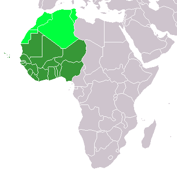
Map: Africa – Western Africa:
|
| Titimangsa | 4 Pébruari 2006 (original upload date) |
| Sumber | No machine-readable source provided. Own work assumed (based on copyright claims). |
| Pangarang | No machine-readable author provided. E Pluribus Anthony~commonswiki assumed (based on copyright claims). |
Lisénsi
| Saya, pemegang hak cipta karya ini, merilis karya ini ke domain umum. Lisensi ini berlaku di seluruh dunia. Di sejumlah negara, tindakan ini tidak memungkinkan secara sah; bila seperti itu: Saya memberikan siapa pun hak untuk menggunakan karya ini untuk tujuan apa pun, tanpa persyaratan apa pun, kecuali yang ditetapkan oleh hukum. |
Jujutan berkas
Klik dina titimangsa pikeun nempo koropak nu aya dina mangsa éta.
| Titimangsa | Miniatur | Ukuran | Pamaké | Kamandang | |
|---|---|---|---|---|---|
| kiwari | 11 Nopémber 2022 13.17 | | 359 × 359 (7 KB) | ColorfulSmoke | . |
| 11 Nopémber 2022 11.56 |  | 360 × 359 (7 KB) | ColorfulSmoke | ||
| 17 Maret 2018 16.47 |  | 360 × 392 (10 KB) | Maphobbyist | Upload | |
| 31 Maret 2016 20.54 |  | 360 × 392 (13 KB) | Fry1989 | Reverted to version as of 21:24, 9 July 2011 (UTC) | |
| 15 Maret 2016 23.24 |  | 360 × 392 (10 KB) | Hpyounes | new colors | |
| 9 Juli 2011 21.24 |  | 360 × 392 (13 KB) | Maphobbyist | South Sudan has become independent on July 9, 2011. Sudan and South Sudan are shown with the new international border between them. | |
| 11 Désémber 2007 08.09 |  | 360 × 392 (14 KB) | Hoshie | added Cabinda (Angola) and Montenegro. | |
| 5 Pébruari 2006 10.55 |  | 360 × 392 (8 KB) | E Pluribus Anthony~commonswiki | Map: Western Africa, including Maghreb (location) | |
| 4 Pébruari 2006 19.52 |  | 360 × 392 (9 KB) | E Pluribus Anthony~commonswiki | Map: Western Africa, including Maghreb (location) |
Pamakéan berkas
Ieu berkas dipaké ku kaca di handap:
Pamakéan berkas sajagat
Wiki lianna anu maké ieu berkas:
- Pamakéan di ab.wikipedia.org
- Pamakéan di ace.wikipedia.org
- Pamakéan di af.wikipedia.org
- Pamakéan di als.wikipedia.org
- Pamakéan di am.wikipedia.org
- Pamakéan di ar.wikipedia.org
- ليبيا
- جيبوتي
- موريتانيا
- تونس
- السودان
- الصحراء الغربية
- أنغولا
- أوغندا
- إسبانيا
- تشاد
- النيجر
- مالي
- السنغال
- غامبيا
- غينيا بيساو
- غينيا
- سيراليون
- ليبيريا
- غانا
- توغو
- بنين
- بوركينا فاسو
- الصومال
- كينيا
- تنزانيا
- الغابون
- زامبيا
- موزمبيق
- زيمبابوي
- البرتغال
- الكاميرون
- جمهورية الكونغو الديمقراطية
- بوتسوانا
- جنوب إفريقيا
- جمهورية إفريقيا الوسطى
- جمهورية الكونغو
- سيشل
- ناميبيا
Témbongkeun pamakéan global leuwih loba pikeun ieu berkas.