Gambar:Volcanic system of Iceland-Map-en.svg

Ukuran ieu pramidang PNG ti ieu berkas SVG: 726 × 588 pixel Resolusi lianna: 296 × 240 pixel | 593 × 480 pixel | 948 × 768 pixel | 1.264 × 1.024 pixel | 2.529 × 2.048 pixel.
Berkas asli (Koropak SVG, nominalna 726 × 588 piksel, ukuranana 345 KB)
| Berkas ieu asalna ti Wikimedia Commons. Kaca ngeunaan katerangan berkas ieu di Commons aya disalin di handap. Commons téh hiji gudang berkas bébas nu eusina disumbang ku balaréa. |
| Pedaran |
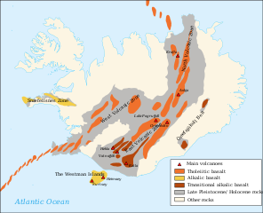
Français : Carte en anglais du système volcanique de l'Islande English: Map in English of the volcanic system of Iceland
Íslenska: Gosbelti Íslands.
A similar but different image that may have informed part of the original image that was created in 2008 is in Sveinn P. Jakobsson, Kristján Jónasson og Ingvar A. Sigurðsson 2008. The three igneous rock series of Iceland. Jökull 58: 117–138. |
| Titimangsa | (UTC) |
| Sumber | |
| Pangarang |
|
| Versi lainnya |
Karya turunan dari berkas ini: |
| Ini merupakan gambar hasil penyuntingan yang berarti bahwa gambar tersebut telah diubah secara digital dari versi asli. Perubahan: English translation. Versi asli dapat dilihat di sini: Volcanic system of Iceland-Map-fr.svg:
|
Saya, pemilik hak cipta dari karya ini, dengan ini menerbitkan berkas ini di bawah ketentuan berikut:
Berkas ini dilisensikan dengan lisensi Creative Commons Atribusi-BerbagiSerupa 3.0 Tanpa Adaptasi, 2.5 Generik, 2.0 Generik, dan 1.0 Generik.
- Anjeun bébas:
- pikeun babagi – pikeun nyalin, nyebarkeun, sarta nyalabarkeun karyana
- pikeun nyampurkeun – pikeun ngarobah karyana
- Dumasar kana kaayaan di handap:
- atribusi – Anjeun kudu ngatribusi karya ku cara nu geus ditangtukeun ku nu nyieun atawa nu méré lisénsi (tapi lain ku jalan nu sigana téh maksa pikeun Anjeun maké éta karya).
- BabagiSarupa – Lamun anjeun ngadumaniskeun, ngarobah, atawa nyieun turunan tina éta bahan, anjeun kudu nyebarkeun kontribusi anjeun maké lisénsi anu sarua jeung nu aslina.

|
Widi dipaparinkeun pikeun nyalin, nyebarkeun jeung/atawa ngarobah ieu dokumén dina payung GNU Free Documentation License, Vérsi 1.2 atawa saluhureunana anu medal ti Free Software Foundation; tanpa Invariant Sections, tanpa Front-Cover Texts, jeung tanpa Back-Cover Texts. Salinan lisénsina diselapkeun dina bab GNU Free Documentation License. |
Anjeun bisa milih lisénsi nu cocog.
Log pengunggahan asli
This image is a derivative work of the following images:
- File:Volcanic_system_of_Iceland-Map-fr.svg licensed with Cc-by-sa-3.0,2.5,2.0,1.0, GFDL
- 2008-03-05T17:48:55Z Pinpin 726x588 (370851 Bytes) '
- 2008-03-04T17:56:34Z Pinpin 726x588 (370488 Bytes) '
- 2008-03-04T17:51:23Z Pinpin 726x588 (369885 Bytes) +volcanoes
- 2008-03-03T10:42:50Z Pinpin 726x588 (356747 Bytes) {{Information |Description={{fr|Carte en français du système volcanique de l'Islande}} {{en|Map in french of the volcanic system of Iceland}} |Source=Own work made with inkscape from [[:Image:Blank map of Iceland.svg]] and
Uploaded with derivativeFX
| Annotations | This image is annotated: View the annotations at Commons |
Jujutan berkas
Klik dina titimangsa pikeun nempo koropak nu aya dina mangsa éta.
| Titimangsa | Miniatur | Ukuran | Pamaké | Kamandang | |
|---|---|---|---|---|---|
| kiwari | 4 Agustus 2019 15.39 | | 726 × 588 (345 KB) | Rohieb | translate "Snæfellsnes Zone" after the original french version is now translatable |
| 18 April 2010 13.44 |  | 726 × 588 (362 KB) | Chris.urs-o | Typo, volcano to volcanoes, high alumina basalt to transitional alkalic basalt | |
| 30 Maret 2010 20.49 |  | 726 × 588 (362 KB) | Chris.urs-o | {{Information |Description={{fr|Carte en français du système volcanique de l'Islande}} {{en|Map in french of the volcanic system of Iceland}} |Source=*File:Volcanic_system_of_Iceland-Map-fr.svg |Date=2010-03-30 20:48 (UTC) |Author=*[[:File:Volcani |
Pamakéan berkas
Ieu berkas dipaké ku kaca di handap:
Pamakéan berkas sajagat
Wiki lianna anu maké ieu berkas:
- Pamakéan di ar.wikipedia.org
- Pamakéan di ca.wikipedia.org
- Pamakéan di cs.wikipedia.org
- Pamakéan di da.wikipedia.org
- Pamakéan di de.wikipedia.org
- Pamakéan di en.wikipedia.org
- Geography of Iceland
- Hekla
- Volcanism of Iceland
- Eyjafjallajökull
- Iceland hotspot
- List of Quaternary volcanic eruptions
- Category:Öræfajökull Belt
- Category:Snæfellsnes
- Brennisteinsfjöll
- User:Avenue/sandbox
- User:Chienlit/sandbox
- Geological deformation of Iceland
- User:GeekyEnki/sandbox/Eyjafjallajökull
- Category:Volcanic systems of Iceland
- Krýsuvík (volcanic system)
- Category:North Volcanic Zone of Iceland
- Category:West Volcanic Zone of Iceland
- List of volcanic eruptions in Iceland
- Pamakéan di es.wikipedia.org
- Pamakéan di fi.wikipedia.org
- Pamakéan di fr.wikipedia.org
- Pamakéan di it.wikipedia.org
- Pamakéan di ja.wikipedia.org
- Pamakéan di ka.wikipedia.org
- Pamakéan di lb.wikipedia.org
- Pamakéan di li.wikipedia.org
- Pamakéan di mk.wikipedia.org
- Pamakéan di no.wikipedia.org
- Pamakéan di pt.wikipedia.org
- Pamakéan di simple.wikipedia.org
- Pamakéan di sr.wikipedia.org
- Pamakéan di sv.wikipedia.org
- Pamakéan di ta.wikipedia.org
- Pamakéan di tr.wikipedia.org
- Pamakéan di uk.wikipedia.org
- Pamakéan di xmf.wikipedia.org
- Pamakéan di zh.wikipedia.org